Whilst growing up, I spent a lot of time driving up and down the Bruce Highway between Mackay and Brisbane. After getting my own license, I continued to drive the east coast and the National Highway, not even thinking of venturing just that little further west and seeing what was on the other side of the ranges.
Thankfully for me, all that changed a short time ago. I had some time up my sleeve and wanted to see some new sights, not just the same thing I had been seeing for the last 40 years.
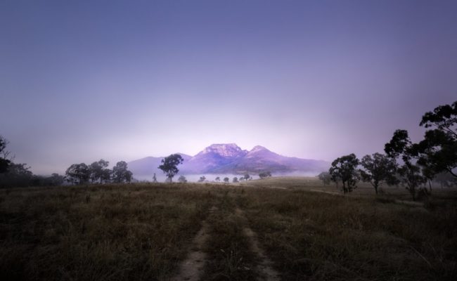
So, after spending some time exploring the towns of the North Burnett Region, I continued further north to Cania Gorge National Park. Cania had always
been on my list of places to visit, but I never really knew why. Perhaps I had seen it on some travel show, where some immaculately manicured and
attired presenter had shown it in a good light. Whatever the reason, after visiting and spending a couple of nights at the Cania Gorge Tourist Retreat,
I'm glad I made the effort. Over the course of a couple of days, I managed to complete all the walks in the park, (except for the multi-day walk
to Castle Mountain) and even see an emu or two.
To say the walks are good, would be a massive understatement. All the walks that I did, were via well formed and maintained tracks, and even though a little bit of effort is required on some of the climbs, could be handled by most part-time hikers. Impressing me no end, was a couple of septuagenarians and one octogenarian that I met on the Two Storey Cave walk! Unlike a good parent (who'll never admit to it, but I know it's me Mum!), my favourite walk was definitely to Dripping Rock and the Overhang. Greens like you've never seen, towering slabs of sandstone and huge tree ferns are just a few of the highlights of this 3.2km return walk through lush rainforest.
Not to be forgotten, Cania Dam, at the northern end of the National Park is a mecca for the budding angler. Species such as silver perch, Australian bass and yellow belly can be caught in the stocked impoundment.
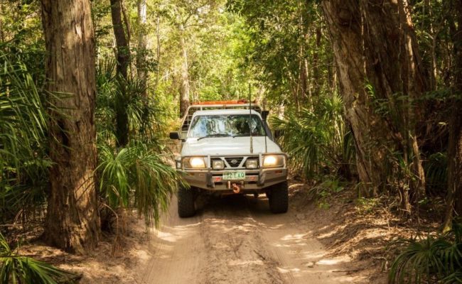
After rolling the swag on a brisk morning, it was time to leave Cania and head a little further north to Kroombit Tops National Park via the back roads. Firstly following Apple Tree Creek Road and then Clonmel Road, which crosses Munholme Creek more times than I care to remember. The dirt road was well maintained, but you can definitely see the signs of where flooding has caused damage in the past. Thankfully for me, most of the fords were barely half wheel deep. The final ascent into the National Park needed to be taken a little slower due to a couple of steep sections and loose surfaces. If you're heading this way with an off-road trailer, you'll have no problems in the dry. Just be mindful that conditions can change pretty quickly in the event of rain.
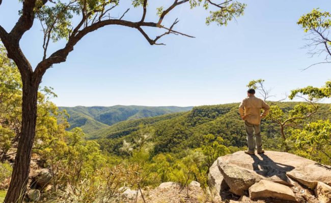
Making it to the top of the ridge, a quick visit to the lookout was in order. Overlooking the surrounding ranges and the Boyne Valley below, you can see all the way to the coast and the port city of Gladstone from this impressive vantage point. A quick mental note was made to return here for sunrise tomorrow.
For those with a 4WD, the Loop Road to the crash site of Beautiful Betsy, a WWII Liberator Bomber, is a must. A short walk takes you to the final resting place of the plane that crashed in 1945. Interpretive signage along the way provides you with a background of the event and the crew members who were on board. A little further along, a natural lookout presents itself, offering gorgeous views of the peaks, ridges and valleys that go into making up this beautiful park.
Set on the banks of Griffith Creek, I spent a night under the stars at the Griffith Creek Campground, before hitting the track early for sunrise back at the lookout. After sunrise, on my way back out of the park following the same track I came in on, I stopped at the Rainforest Walk. The sign said that is was a 300m, 10 minute return track. Well, I got stuck in this little pocket of tropical rainforest for over an hour. Now, when I say 'stuck' I certainly don't mean it in a bad way. This was an absolute gem of a track near Munholme Creek through thick undergrowth, tall palms and massive tree ferns.
I could have spent longer exploring this spot, but I needed to get on the road to my final destination for this trip, the Boyne Valley.
Descending to the valley floor via a rough and steep dirt track, soon had me at the small township of Ubobo, before heading further south to Buyilan and Many Peaks. There's a great looking old pub at Many Peaks. Unfortunately for me though, the pub is closed Monday's and Tuesday's and today was Tuesday. Bugger!
Oh well, next up was Dawes National Park, where I had been given the good oil by a local that there was an abandoned copper mine, where two brick chimneys still stand. After driving through, across and along Little Glassford Creek, the two chimneys literally stick out of the surrounding scrub like a sore thumb. Take your time to have a wander around the site before returning the same way out of the park.
Camping for the night was at Boynedale Bush Camp, on the banks of the Boyne River. This free camp has a boat ramp and toilets, and is very popular with the fishing, boating and caravanning fraternity.
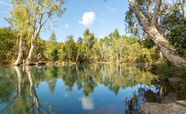
On leaving the Boyne Valley the next morning, as I headed back towards my old friend the Bruce Highway via Blackman's Gap Road, I stopped at the waterhole of the same name. A picturesque little spot on Blackman's Creek that no doubt gets very busy come summertime.
Needless to say, after exploring this region over the past couple of days, I won't be so quick to pass it by in the future.
This blog post was written by Matt Williams, who was a guest of the Southern Great Barrier Reef.